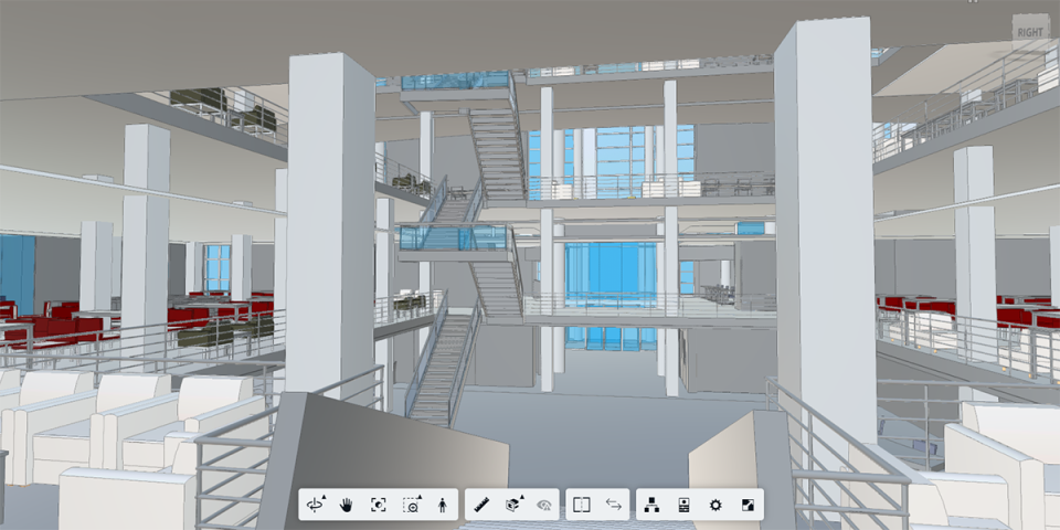
View 3D building models, floor plans with BIM 360
Facilities Information and Technology Services (FITS) provides faculty and staff free access to BIM 360, a user-friendly online platform for viewing 3D models and floor plans of university buildings for projects and daily departmental operations. Access the information easily via the web or the free BIM 360 mobile app. No additional software or special skills are required. Models are actively...