Experience Ohio State in new ways through the new 3D Campus Explorer tool and upgraded GIS maps. Join our team for online training sessions on October 28 and 30 to explore powerful tools that bring campus to life. Learn how to interact with 3D building models and fly-through animations to floor plans and space data by cost center. University employees can register below.
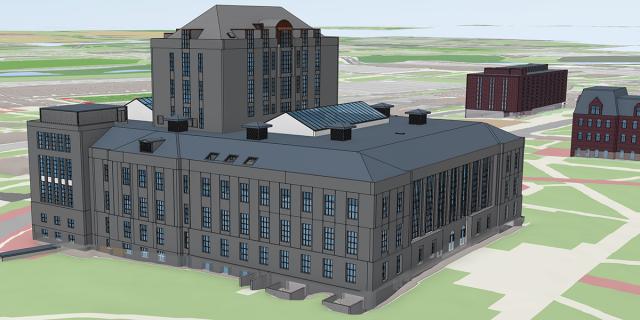
New 3D Campus Explorer
This powerful planning tool allows faculty and staff to view the campus like never before. 3D Campus Explorer gives users the ability to:
- Load multiple buildings onto campus
- Turn on floors and slice through buildings
- Create fly-throughs
- Render shadows and elevation profiles
- Determine line of sight from selected points
- Please note: 3D Campus Explorer requires a university login.
Upgraded GIS Maps
After more than 10 years, GIS Maps has been completely rebuilt! The new version is faster, more intuitive and packed with new features.
- View utility data
- Download data in multiple formats
- View and query floor plans
- Access building assessment reports and more
- Please note: Some GIS Maps layers are not visible / have restricted access.