If you could rewind time and witness every transformation The Ohio State University’s campus has undergone since its founding in 1870, would you? Thanks to the relentless efforts of Aaron Kidwell, senior geographic information system (GIS) analyst for Facilities Information and Technology Services (FITS), this vision has become a reality. During the past five years, Kidwell has poured his heart into creating an interactive map of Ohio State’s Columbus campus history, combining cutting edge technology with a passion for preserving the past.
“Every physical thing has a location and a history,” said Kidwell. “This historic map is a record of Ohio State’s physical campus and shows us the time and change that our campus has endured over the years.”
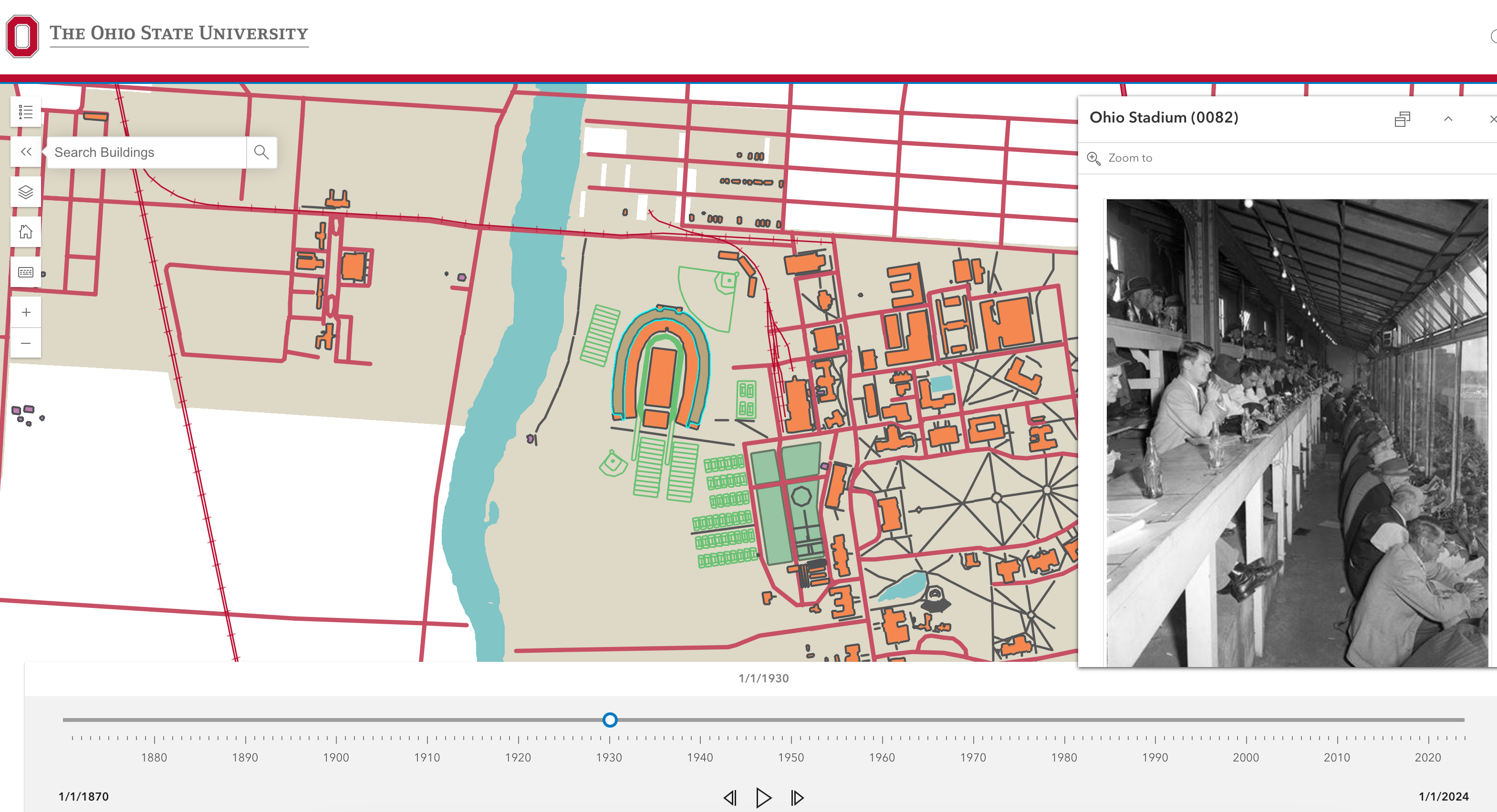
This new, interactive tool allows anyone to explore the university through historic maps and photos by using a slider to engage with the content in each year. It includes all buildings, streets, sidewalks, water features, recreation sports fields, rail lines, major gardens, tunnels, parking lots and even ownership boundaries, all meticulously cataloged year by year. Users can click on different buildings to see photos of their history and learn more about spaces and places.
“I looked at hundreds of old campus maps and photos. Then random things like rail lines and tennis courts from the 1920s started popping up,” he said. “So, I knew if I was going to start this project, I had to somehow include every physical feature.”
The idea to create the map was inspired by the John H. Herrick Archives, which is a comprehensive listing of all of the buildings on record from day one of the university.
“John Herrick did such an amazing job digging through old maps, photos and Board of Trustees minutes to create this body of work. I wanted to bring his information to the digital universe to make it easier for users to navigate.”
Kidwell says he dug through anything he could find with any mention of campus history. That included maps, aerial imagery dating back to the 1950’s, Board of Trustees archived minutes, University Archives, archived Makio records, archived Lantern records, Ohio State photo archives, the Space Information and Management Systems (SIMS) database of historic civil, architectural and landscape archive drawings, and many more.
“This has been a labor of love. On more than one occasion my wife has found me sitting in my home office at 3:00 a.m. on a Saturday morning reading Board of Trustees minutes from 1889…or maybe it was 1930.”
Kidwell explained that during his history research, he uncovered some hidden gems. One of which was the “Black Diamond” rail car that was on campus from the mid-1910s to the late 1920s. It was a United States Bureau of Mines Pullman car that was retrofitted as a rescue car, which would rush to coal mine disasters throughout the region. Ohio State’s School of Mines was one of the top departments in the United States at that time, so the university was entrusted with the task of staging the car.
The historic map is more than a resource, it’s a dynamic time machine that will continue to grow. Kidwell plans to update the map annually, ensuring it remains a useful tool for students, faculty, staff, alumni and history enthusiasts to enjoy for years to come.